|
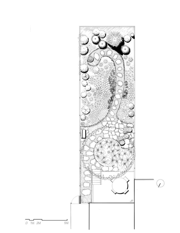
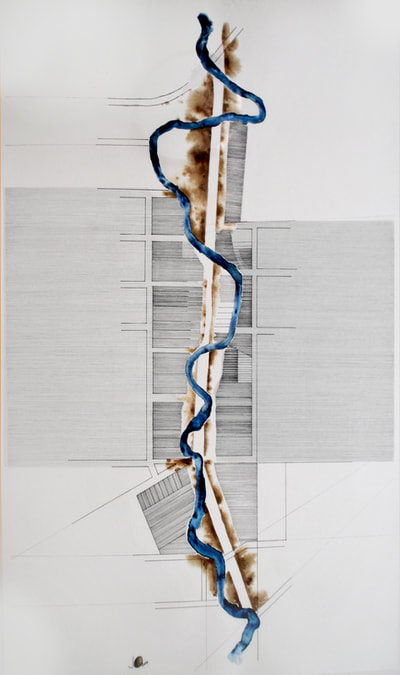
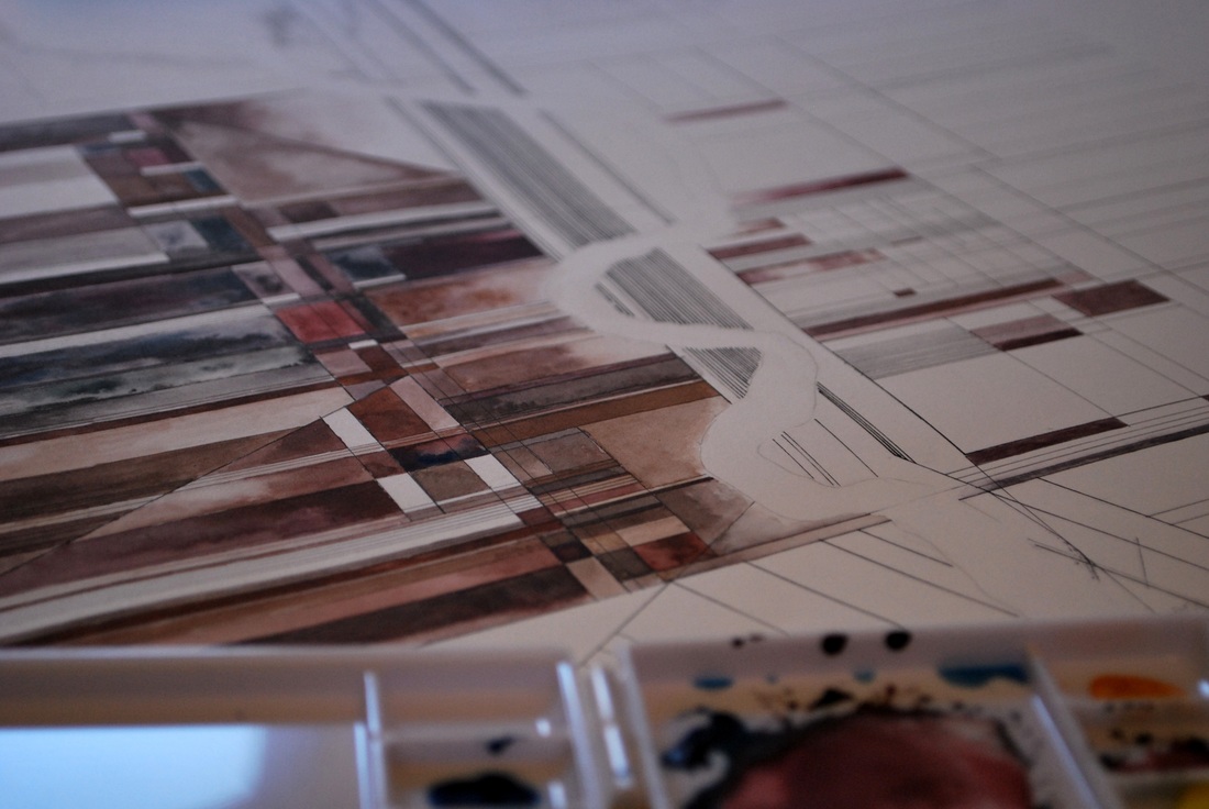
While we hibernate, changing a technical landscape plan into a pen drawing is most gratifying. Looking forward to the spring to get things into the ground.
0 Comments
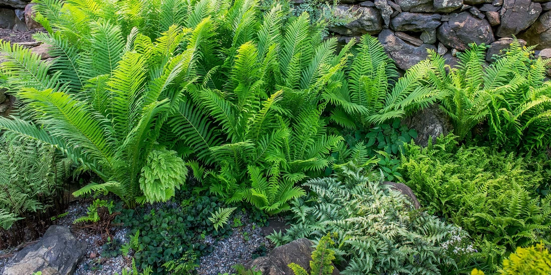 Embarking on the next phase, I will be providing landscape design services! The journey is starting with the vision... To create thriving landscapes using ecological garden designs and management techniques. To creatively consider every landscape challenge with solutions that maximizes the effectiveness of the client’s investment. To satisfy the client’s functional needs with creative approaches that address problems with practical and dramatic solutions. To inspire gardeners and potential gardeners to contribute to plant biodiversity, provide a haven for wildlife and nature lovers, while doing no harm to the earth, wildlife, or those who maintain the garden. To repeatedly learn from the natural world, other gardeners, and the scientific community about new and effective techniques for sustainable garden design and execution. Long-term Changes in the Biodiversity and Ecological Integrity of Toronto’s Ravines After reading CBC's Ecological collapse of Toronto's ravine system has begun, (Muriel Draaisma · CBC News · Posted: Nov 04, 2018), I am stunned to discover that native plant animal and insect species are disappearing from our Toronto's ravines. To comprehend that 17% of Toronto's land are dying is a disturbing truth.
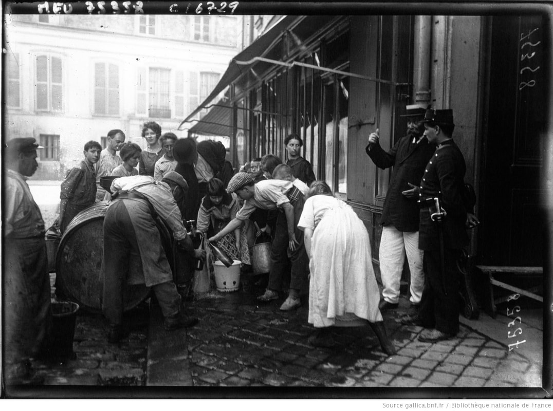
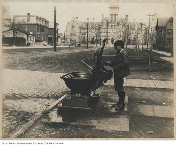
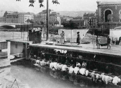
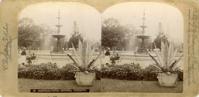
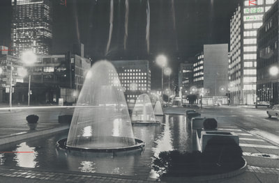
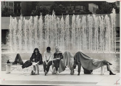
In the 1977-2017 report, (Eric Davies, Anqi Dong, Catherine Berka, Paul Scrivener, Dale Tayl or, Sandy M SmithFaculty of Forestry, University of Toronto July 2018) important restorative methodologies are proposed, including an increase in ecological connectivity and buffers for biodiversity, to regenerate and reintroduce: seed forecasting and collection, as well as to plant ‘local’ native species and remove invasive species. Bringing the Toronto Ravine Strategy to the forefront of our community is obviously of great importance. Perhaps taking cue from the rapport and expanding our understanding and knowledge of native species, invasive species and our role to seed or remove, might make a difference in the future of this Ecological collapse. With the growth of modern supply systems, the social purpose of water has slowly disappeared. Public fountains and wash houses were places of meeting and exchange that played an essential role in the life of a city or a village. Water was at hand in the street, it created a rhythm to the day, it manifested out the routes of the people. Nowadays, water is far more available but it mostly travels along hidden pathways, it flows behind the walls, it moves smoothly under our feet and only makes uncommon appearances in public. If the walls and the soil were transparent, if they exposed only the pipes of the water system, we would stand before a giddy complex structure, one that trembles with water rushing in all direction. The fountains dispersed in our cities allow us to break from our daily routines, fountains which compel us today to play with water. As summer approaches, I am encouraging everyone in the city to reconnect with our urban water features, and let themselves be absorbed by the pleasure of water. Water, like the air, is obviously blue. But the colour only can be apparent when there is a confident thickness of the parts. Fountains modify the colour of water by playing with the qualities of the walls and sinks, the depths of the fountain, and the angles of observation. The mirror effect, which is obtained on broader planes of waters, is also a result of the angle from which the water is sighted and the colour of the basin’s bottom. The final water colour is dependent upon a combination of features. petits liens vers l'histoire...
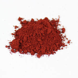
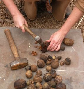
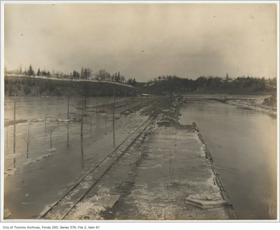
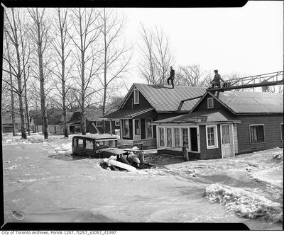
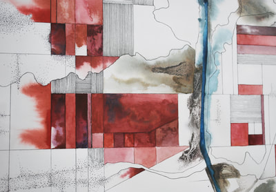
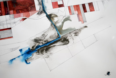
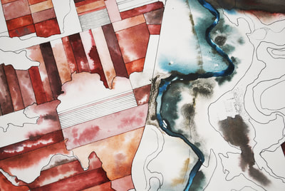
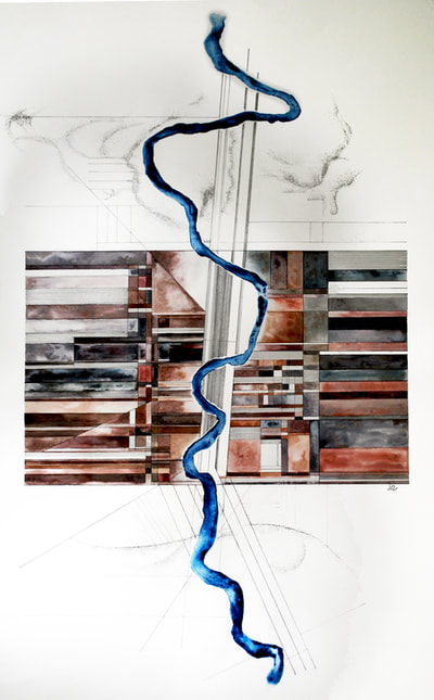
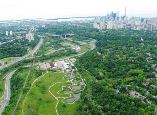
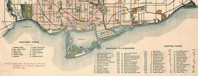
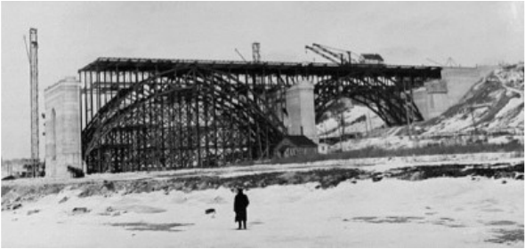
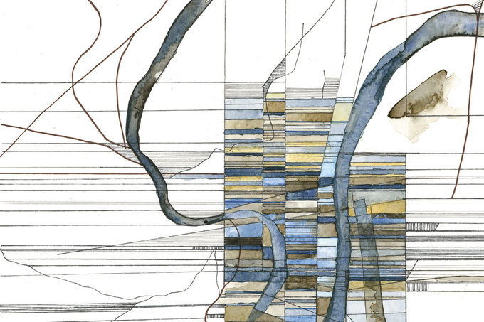
Petite histoire des plus belles fontaines parisiennes Taylor drinking fountains Toronto fountains Les bateaux lavoirs de Paris I enjoyed listening to CBC's the Current this morning, where origins and discoveries of colour pigments were discussed. Show Site: http://www.cbc.ca/thecurrent From Oak Galls to rocks and soil, many natural elements are available in our environment. There are so many paints and dyes which are chemically mass-manufactured and often transported over long distance to reach our stores. Many of these dyes and chemicals make their way into our rivers. Also, natural pigments are better than synthetic dyes. The natural dyes are better products, simply because they do not contain chemicals harmful to health (therefore healthier and more reliable than chemical synthetic dyes). Looking back, 19th century natural tanneries had many lovely colourful dyes, yet in Toronto, the organic waste was mismanaged. As tanneries, breweries, and other industries multiplied along the lower (Don) river in the latter half of the nineteenth century, the river's ability to assimilate these wastes would have been seriously compromised. Sewage and industrial pollution undoubtedly had serious consequences for riverine ecology. -Making an Industrial Margin, Reclaiming the Don, Jennifer Bonnell, We could keep our focus as consumers and creators, that natural colors always offer contrasting shades and ranges of hues are impossible to achieve with artificial colourings. The vegetable dyes represent a sustainable source with respect to their synthetic counterparts, they are a renewable resource while the synthetic dyes come from oil.  http://www.jasonslogan.com/thetorontoinkcompany/ http://www.jasonslogan.com/thetorontoinkcompany/ Great to have the Current share Jason Logan's perspective and insight on natural inks( Toronto Ink Company). I discovered how natural dyes can be extremely exciting and vivid last summer, when my two boys spent hours crushing oak galls by laying them on the street and waiting for cars to crush them, then smearing their hands in the natural dyes and creating delightful sidewalk art. I wanted to share one of my pieces in which I looked at the various scales of parcels of land, built wood and brick buildings, and the swelling and flooding of the Don River. The piece is part of the Don River + Toronto series in which I could not overlook the long standing history of flooding along the lower Don. I am looking forward to exhibiting all seven pieces together in the near future. Don Valley Parkway flooding. Here's why it happens so often, Scott Sutherland Meteorologist/Science Writer It was Hurricane Hazel, which blasted across Toronto in 1954, that served as an effective wake-up call for the disaster potential that still existed in the valley. River flows during the storm have been estimated at around 1,700 cubic metres per second, which is over 400 times greater than the normal average flow the river experiences. There hasn't been anything quite that bad since, but the government did ban development in the valley (as well as other flood plains) as a result of that disaster. Still, less than four years later, in 1958, construction crews broke ground on the newly approved Don Valley Parkway, which was going to wind its way right through the middle of the Don River's flood plain, and the city continued to grow around it, laying down even more concrete and asphalt up and down the lands that border both sides of the river valley. Great stories and accounts of Torontonians displaced and rescued can be found in the Canadian archives. All of the accounts, along with images and descriptions in Jennifer Bonnell's Reclaiming the Don: An Environmental History of Toronto's Don River Valley, had me draft and paint this piece, which plays a key role in the Don's recent story. FUTURE PLANS Lower Don River West Remedial Flood Protection Project describes in detail the flood protection systems, and their environmental effects, for the elimination of the flood risk of the Lower Don River. Full report found here. When creating these two pieces, I was clearly looking at the past, present, and future impacts of the Don River straightening. Insights into the past were linked with the book Remembering the Don: A Rare Record of Earlier Times Within the Don River Valley, by Charles Sauriol `The straightening of the Don river was considered necessary to provide land primarily for industrial purposes, and to also make available an additional railway entrance to Toronto. The Don with a greater depth of water after improvement could also be used to convey shipping. From then on, the lower Don river and lower valley of the Don lost their original appearance. Gone the small five islands in the stream between Queen and Winchester streets; gone the care-free ice skating on the river; the beating to picnic spots upstream. With `the Don Improvement`, the last vestiges of a sylvan loser Don Valley disappeared forever.` The present active changes to the Don River Valley Park Our stunningly beautiful valley system has remained largely overlooked for decades, but not anymore. As the “backyard” to 250,000 residents (and soon another 60,000), representing some of the greatest cultural and economic diversity in Canada, reclaiming and protecting the Don Valley has never been more important. And the future City of Toronto by-laws and re-design of our green infrastructure. Jake Tobin Garrett wrote a very insightful piece, Resilient Parks, Resilient City: The role of green infrastructure and parks in creating more climate-adaptive cities, explaining the essence and positive impacts of properly designed and controlled parks in Toronto. My pieces reflect on the initial and long term impacts the Don straightening has suffered. I hope to show these two together this spring. The present active changes to the Don River Valley Park Our stunningly beautiful valley system has remained largely overlooked for decades, but not anymore. As the “backyard” to 250,000 residents (and soon another 60,000), representing some of the greatest cultural and economic diversity in Canada, reclaiming and protecting the Don Valley has never been more important. And the future City of Toronto by-laws and re-design of our green infrastructure. Jake Tobin Garrett wrote a very insightful piece, Resilient Parks, Resilient City: The role of green infrastructure and parks in creating more climate-adaptive cities, explaining the essence and positive impacts of properly designed and controlled parks in Toronto. My pieces reflect on the initial and long term impacts the Don straightening has suffered. I hope to show these two together this spring. The last 117 years have seen Toronto's growth explode to unimaginable heights. These maps are showing beautifully the growth and expansion, which in the youtube video from The Shape of the Suburbs in Fall 2013 roundtable, are mesmerizing to me. Notice the obvious unshaded areas revealing parks and ravines, hydro corridors and railroads. The book, Toronto: Transformations in a City and its Region, examines the transformations in Toronto since its founding in 1793, and contains many insightful images and maps to understand the extent of Toronto's mutations. The next images to study could possibly be be the obvious third dimension, the vertical sprawl? The base map is current, Highway 401 and the Don Valley Parkway shown for reference, and many of the arterial roads shown here were only opened all the way after 1950. Images produced by “Toronto Transforms”, the website is an extension of Edward Relph`s book Toronto: Transformations in a City and its Region, published by the University of Pennsylvania Press, 2014 as part of its series of portraits of metropolitan regions of North America.
 Opening Thursday Dec. 7th, 7-9pm December 1 - December 14 1351 Queen Street West Toronto process photographs
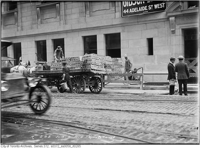
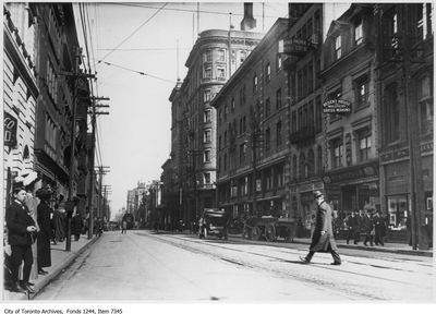
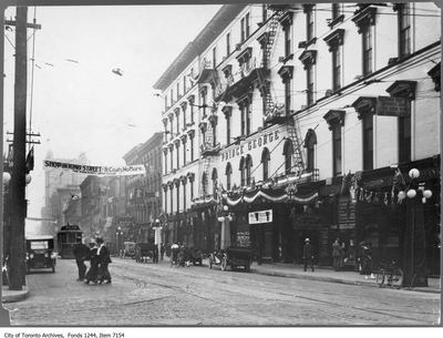
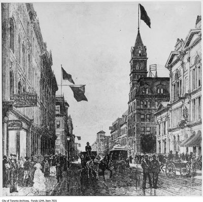
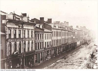
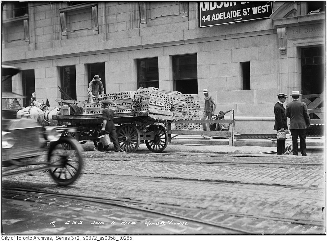
My fascination with maps is matched with my love and interest of building elevations. My recent drawings will experiment with combining the motion of cars and streetcars with our city's historic buildings outstanding views. I am hoping the results will present frozen-in-motion depictions, moments that, in real time, would be lost in a blink of the eye, heartening a link with familiar buildings, presented in unfamiliar ways. How can we appreciate the details and ornaments of the remaining heritage buildings when in fast motion? Can we remain engaged with our historical Toronto? Perhaps we not only glimpse through the window, but snap quick shots with our digital phone cameras?
I turn my initial studies to King Street East. My references will include once the City of Toronto Archives, my well known source of visual inspiration. My mothers family is from Cornwall, and from the St. Lawrence River area. Memories of jumping into the cold waters of the St Lawrence in front of my great-grandmothers home, of being pulled by the strong currents and of watching, scared, the large vessels thrusting on. The St Lawrence River had made great impressions on me. It is apparent to me why I am so affected by this moment in time; July 1st 1958. The moment in time, when 10 villages were lost. Flooded to make way for the future.
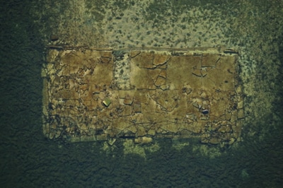
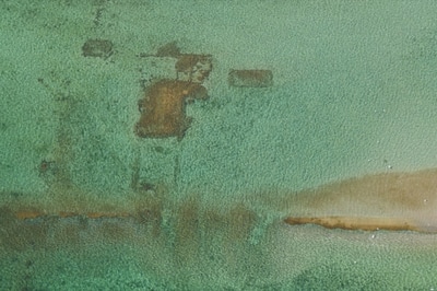
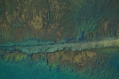
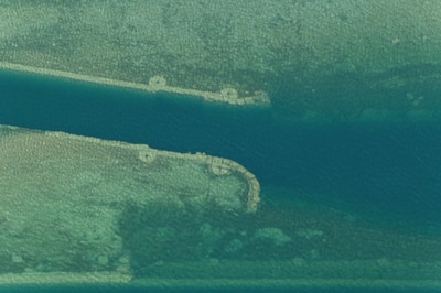
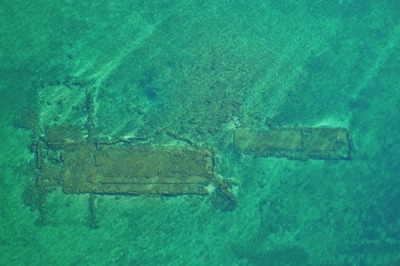
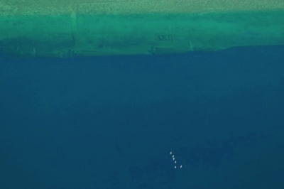
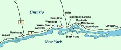
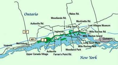
Louis Helbig's aerial photographs outline the remnants of these villages. In the National Gallery of Canada video,October 2 & 3, 2013, Ottawa, Ontario, Canada, images of Louis Helbig's Sunken Villages project are set to the voices of some of those affected by their flooding and destruction in the 1950s. The emotions lie closer to the surface than the remains of the villages in the St Lawrence River. One pilot interviewed remembered: (Helbig, Sunken Villages): There was one thing, when they were cutting down all the trees, and the seaway, when the river was still there. They had started cutting down trees and moving buildings (...)on the south side, there was a point, when you were coming down the river, there was one big long pine tree down that point. The pilot would tell you stare on down to the pine tree. I was coming down on one trip, and the pilot mentioned, steer on to the pine tree. I was coming down there, last trip, when he mentioned, steer on the pine tree. No pine tree. They'd cut it down. So I questioned them, I guess, what pine tree? so... He looked out, and noticed it was gone. That was the first time I'd seen a grown man cry. That was his last trip. The Lost Villages of Mille Roches, Moulinette, Wales, Dickinson’s Landing, Farran’s Point, and Aultsville; the hamlets of Maple Grove, Santa Cruz and Woodlands; and the farming community of Sheik’s/Sheek’s Island, were not lost through carelessness, they were disposed of with Government approval “for the common good”. Over 6500 people were displaced in the name of progress for the sake of the St. Lawrence Seaway and International Hydro Electric project. Casualties of progress, the villages and hamlets disappeared beneath the waters of the newly created Seaway. I plan on making my way to the Don River Valley Park Art Trail this spring, where artist Duane Linklater will get us looking at the trajectory of Toronto’s history and the changes made to the natural environment with the development of cities in settler societies.
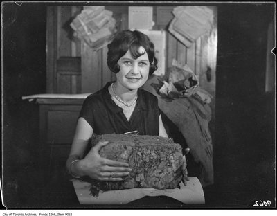
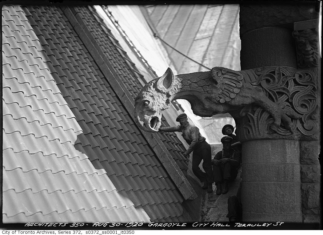
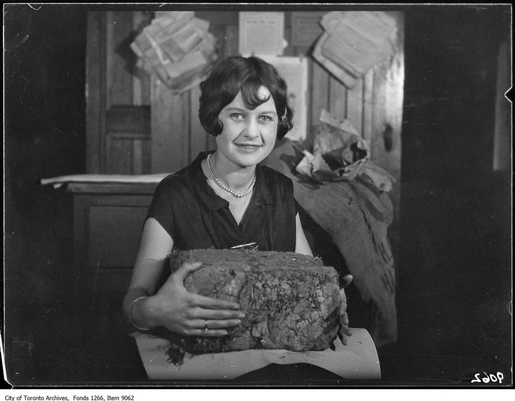
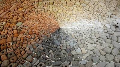
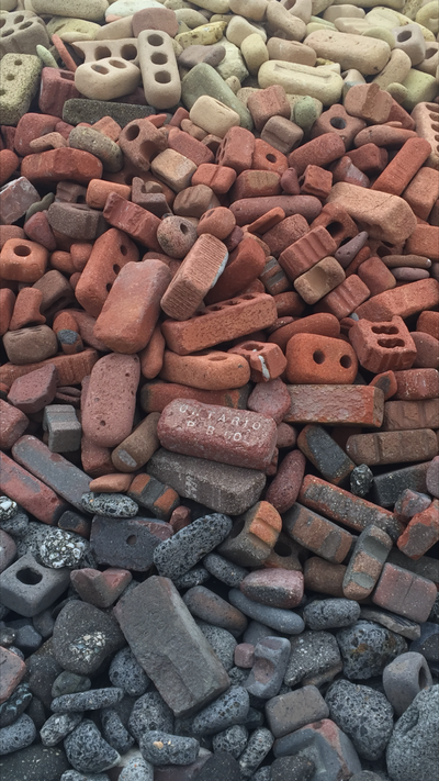
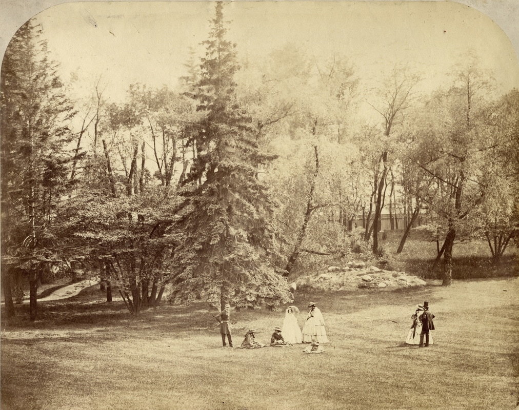
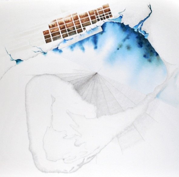
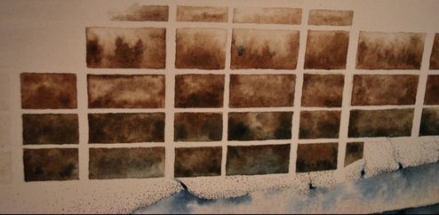
Looking at the workers leaning on the Old City Hall majestic Gargoyles in these stunning photographs, one cannot help but admire the craftsmanship which ties our knowledge of historical buildings to our hands and earth. We remember that the tactility of details was, is, should be important. There is a sensation evoked by the materiality of stone, of brick, of their voice. Our connection to clay in Toronto one of great physical presence, and one I believe to be too often disregarded. I am drawn to artists Linklater and Ben Watt-Meyer who investigate themes of archeology, architecture and social history. Tracing the Mills along the Don River, it was this beautiful photograph of Miss Hodgson, holding the massive brick of clay, stating the importance of this lump, which keeps leading me back to the material, to reaction. Peter Zumthor delivered an enthralling lecture in 2003, in which he lead his audience to Atmospheres, thus, materials. Materials react with one another and have their radiance, so that the material composition gives rise to something unique. Material is endless. Take a stone; you can saw it, grind it, drill into it, split it, or polish it - it will become a different thing each time. Then take tiny amounts of the same stone, or huge amounts, and it will turn into something else again. I believe when walking along the Don River this spring, engaging with past building materials, Linklater will perhaps be bridging time, maybe raise awareness. I have recently completed a drawing/painting inspired by tones, depth, order, content and maps of the initial Toronto settlement and grid. The dependence and turn to the Don River and the Don Valley is quite obvious in this drawing. Most importantly, observing many paintings and maps, I was struck and inspired instantly when finding this particular print. The print (here below) is one depicting the casual meeting at the Government House. The setting is massive in scale, the beautiful trees and open lawns bring us to a different world in Toronto, with a sensuous sense of space, luxury I could say, and calm. Hard to image this former King Street. The Albumen print, also known as albumen silver print, used the albumen found in egg whites to bind the photographic chemicals to the paper and became the dominant form of photographic positives from 1855 to the turn of the 20th century. The Gallica site has a wonderful description of its origins. The space in the drawing is precisely what we have a hard time imagining in our intensifying, dense, city. Here is a detail of the grid within the painting, where the town would have rooted, inspired by materials, textures, and the depth of this photograph.
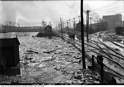
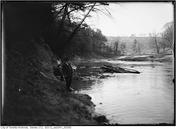
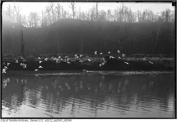
It’s that time of the year again, when we pull out our shovels and our winter mittens. Growing up in a small town along the French River, one of the first things I loved to do as a child was to play outside all year long. This soon included developing snow-fort and igloo building skills, and of course, skating. Canadians in general have a great preoccupation with ice. As soon as the first frost arrives, our towns and cities open their skating rinks, and the excitement begins. I believe one of our great national winter sport to be skating, and when looking at these wonderful archived photographs, the Don River seemed to have been particularly animated during the winter. As the new Don River Valley Park develops and shares its vision of `Creating places that integrate culture, nature and community` and `Provide moments for contemplation, where visitors can engage with the landscape`, I cannot help but wish some vision of our winter landscapes and activities could be integrated into the vision and publicity. How great would it be to see Torontonians encouraged to come out, on the Don River, in full force with their friends and families to enjoy the cold weather and a fun afternoon on ice-skates! 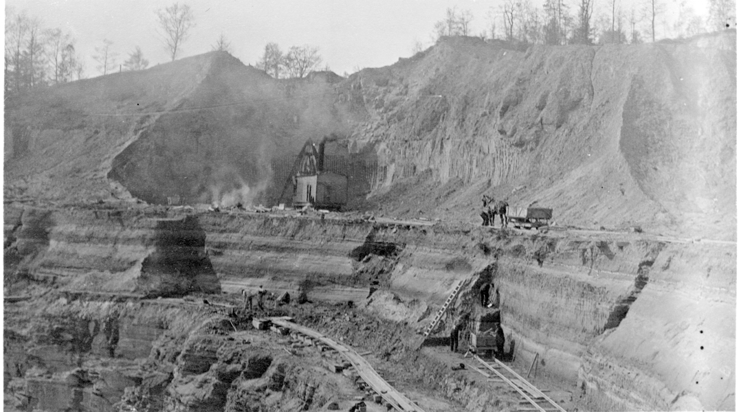 Photograph. A.P. Coleman. Don Brickyard. 1927 ROM Archives. A.P. Coleman Collection Photograph. A.P. Coleman. Don Brickyard. 1927 ROM Archives. A.P. Coleman Collection The Canadian Encyclopedia explains clearly that, fundamental to all ordering of events of the Earth's history, is the principle of the positional relationships of rock and mineral bodies. Having recently read through various surveys and historical accounts of the Toronto bedrock, I am completely captivated by our timeline, which brings us back to the Gerogeian Bay Formation, 450,000,000 years ago. Inspired by layers and textures of surfaces and sections, these few images are a great resource. August 4th, 1793, from the DIARY OF MRS. SIMCOE
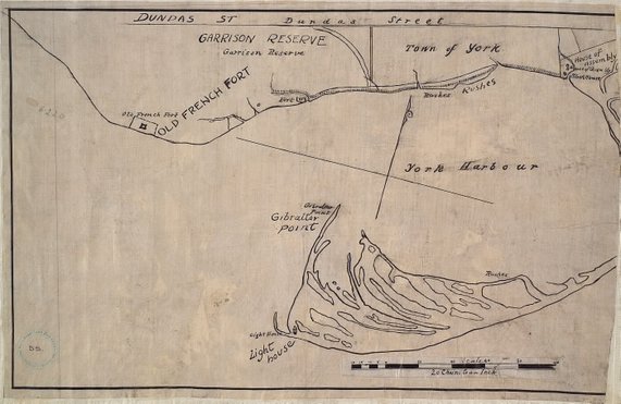
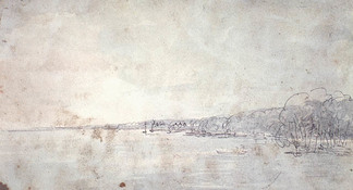
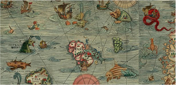
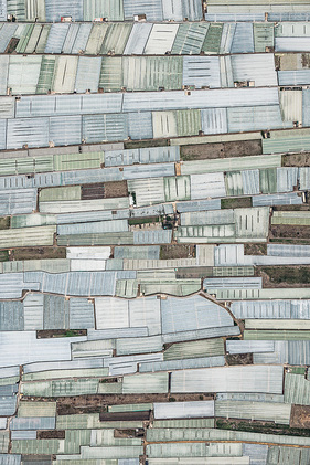
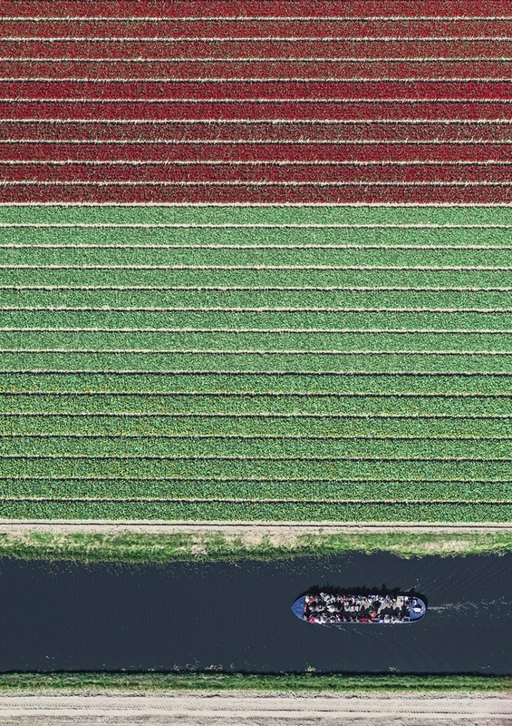
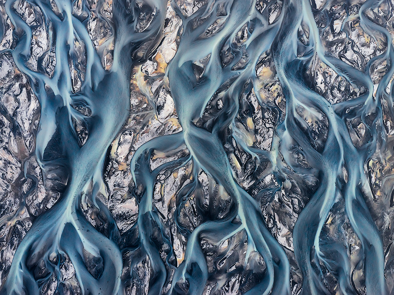
`(...) situated on that part of Toronto bounded by George Street on the west, Parliament Street on the east, Queen Street on the north and Toronto Bay on the south. Early pictures of that part of the city show oak trees along the line of Palace Street, the present Front Street. The spit of land is the present island, in 1793 a peninsula.` Sun. Aug. 4th We rode on the peninsula opposite Toronto, so I called the spit of land, for it is united to the mainland by a very narrow neck of ground. We crossed the bay opposite the camp, and rode by the lake side to the end of the peninsula. NOTE. The party crossed the bay of Toronto from their camp on the shore near the site of the Old Fort, and landed at the present Hanlan's Point, known in the early days as Gibraltar Point. This point is shown in all the Government maps from 1796 as "Gibraltar Point." When Mrs. Simcoe writes later on that the "Onondaga" on her way from Kingston to York was "off Gibraltar Point at York" when passing the present Lighthouse Point, she wrote in error. The peninsula in 1793 joined the mainland at the foot of the present Woodbine Avenue. In 1854 the waters of Lake Ontario broke through and created the present Island. Later the eastern channel was made, now used by the largest lake boats. `We met with some good natural meadows and several ponds. The trees are mostly of the poplar kind, covered with wild vines, and there are some fir. On the ground were everlasting peas creeping in abundance, of a purple color. I am told they are good to eat when boiled, and some pretty, white flowers, like lilies of the valley. We continued our ride beyond the peninsula on the sands of the north shore of Lake Ontario till we were impeded by large trees on the beach. (...)The shore is extremely bold, and has the appear- ance of chalk cliffs, but I believe they are only white sand. They appeared so well that we talked of building a summer residence there and calling it Scarborough.` The party rowed east on Lake Ontario, to the present highlands known from the name given them by Governor Simcoe as Scarborough Heights. The summer residence was not built at the Heights, but a couple of miles up the Don River at the place known as "Castle Frank." For more than 5000 years ago, maps were fundamentally tools used for the map maker, to trace location of places of concern, of importance, and used by many as a source of knowledge about the geography of the area being mapped. Through maps, we recognise their meaning, value, and consequence in our lives, historically and currently. This evolution is informing each viewing of historic map connected to my project. We have changed our perception over time, our maps have evolved. Maps depicted small areas, and are now viewed in ways where no boundaries subsist. Maps were illustrative and symbolic in nature, showing description that the map maker wished to documentation, and the relationship between features of the map and truth on earth was seldom accurate. Currently, cartographers measure and map with precision and consistency, using satellites, and we see maps as critical. The Atlantic has an intriguing slideshow comparing cartographic representations of major cities in the 16th century, and modern Google Maps views. In many cases, the difference in underlying geography are striking: london’s Thames river actually bends in a totally different way from what was initially mapped, Istanbul’s peninsula is very different in shape, and Milan’s nowhere near as round at its core as older maps portray. Artists Bernhard Lang and Emmanuel Coupé Kalomiris are creating critical dialogues, casting light on the crucial issues of climate change. “What interests me is that there is no square left in the world that hasn’t been shaped by humanity, not even our forests,” Lang says. “Nature is in retreat everywhere. That’s something you cannot comprehend from our usual perspective on the ground.” These views are inspiring my progression, allowing me to shift scale, perception, and explore the graphic language and meaning of my drawings. We understand the impossible task of creating an accurate representation of our world, since the 2nd century, the Roman Empire’s cartographers knew that drawing a precise map of the earth is practically impossible; the world is round, a map is flat. Perhaps the most challenging exercise is capturing the essence of our world; the unfailing change. Daily, with the world population increasing at alarming rates, I find myself thinking of Toronto's unsustainable consumptions, and how our city is creating an increased pressure on the ability for our planet to support its living beings. Toronto's past and future is still at the heart of my artwork. I question how the preservation of resources, which includes air and water, addresses various environmental issues related to urban activities, and the impacts of urban metabolism on the quality and availability of these same resources. Is Toronto striving to achieve a balanced urban ecosystem? I understand urban metabolism to be the result of likeness between humans and living organisms, how they consume, transform and reject energy and matter. The city is the seat of interactions and exchanges between the living beings that inhabit (biotope) and the territory which supports (biocenosis), our ECOSYSTEM. Is our city, our urban metabolism, allowing a proper support and supply of its materials and energy for our growing pollution? Is the population density changing the energy demand, water, food, fuel or other raw materials to the city? and to what extent?
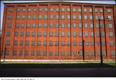
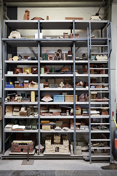
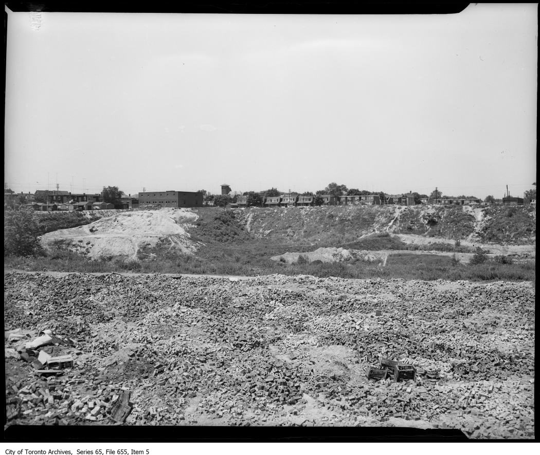
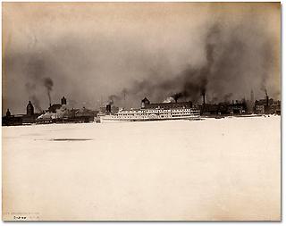
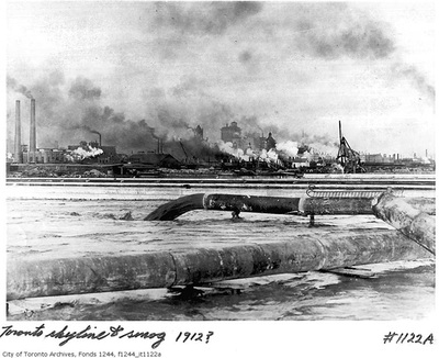
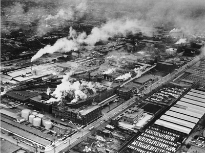
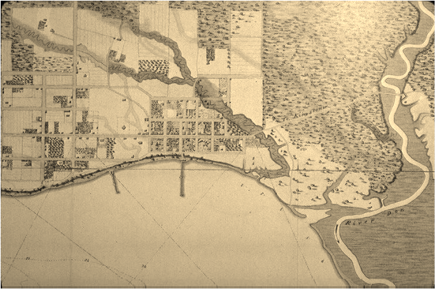
The conversations are not loud enough, public enough, in my opinion, concerning the potential impacts of these studies. My community is not stressing the impacts of urban consumption of resources. Yes, the city consumes or absorbs in its metabolism the air, water, food, raw materials, energy and consumer goods . It rejects the material in the form of gas, solid waste or wastewater and energy such as noise and heat. All this constitutes the waste from its metabolism. I am considering, while tracing memories of the Don River and its surroundings, Toronto's metabolism, which includes inputs and outputs. Human and animal nourishment and discharge Water Sewer liquids Sewer Solids Cargo Combustible liquids Combustible solids Glass Plastics Cement Wood Iron and metals Paper Carbon Monoxide Oxygen Carbon Dioxide Nitrogen oxide Hydrocarbons Particles Coal dust Lead Aeroplane Emissions An easy way to request, demand, an increase in knowledge and population awareness , should be through the city of Toronto Environment and Energy division (email: [email protected]), yet, when reading the city's statements ( http://www1.toronto.ca), without sounding pessimistic, how featured initiatives for greening city operations are SO FEW! Lets look at Oslo, Norway, Malmö, Sweeden, Freiburg, Germany for example, where solar and biomass provide the bulk of the city's renewable energy, and where homes produce more energy than they use. Past to Present to Future Toronto, lets truly strive for a Sustainable Development, which meets the needs of the present without compromising the ability of future generations to meet their own needs. 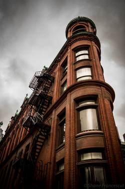 The red-brick Gooderham Building is a historic landmark of Toronto, located at 49 Wellington Street East. The red-brick Gooderham Building is a historic landmark of Toronto, located at 49 Wellington Street East. In Chris Bateman's A brief history of the Don Valley Brick Works , layers of the Toronto Brick Works, Don Valley Bricks, are unveiled. What has always resonated with me, is the fabric of Toronto... If right now you're sitting in a building built before the second world war, there's a chance the walls came from the Don Valley. Inspired by the process, layers of time and extreme temperatures have formed our landscape. Tracing back the origins of our built form, the importance of the late 19th century discovery by Taylor is at the heart of our 20th century city. According to C.Sauriol (1981), the origin of the Brickworks can be traced to the year 1882. During the spring of that year, William Taylor and an assistant were at work erecting a fence in the valley of the Don River. Clay being brought to the surface as postholes were being dug caught the attention of Taylor, who became curious as to its potential for brickmaking.The following day, Taylor packed two cigar boxes with the clay and took them to a local brickworks for firing. Here, Sauriol stated, a discussion took place between Taylor and the owner of the brickworks as to the colour of bricks which would be produced by firing. Taylor maintained that red bricks would result while theowner suggested that yellow ones would be produced. The clay did in fact produce very fine quality red-coloured bricks. Further testing on the site convinced Taylor and his brothers to establish a brickworks. A full historical account of the company's development and impact on the city is on the Evergreen website. 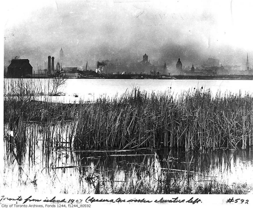 "Whoever wishes to foresee the future must consult the past; for human events ever resemble those of preceding times. This arises from the fact that they are produced by men who ever have been, and ever shall be, animated by the same passions, and thus they necessarily have the same results." Machiavelli The latest paintings, influenced by 1820-1960 maps of the Lower Don River, Toronto as well as the harbour, will explore the water content. We know Toronto to have been greatly influenced architecturally by industrial establishments which were inevitably creating industrial waste. In the 1860s and 70s, widespread adoption of stream power stimulated industrial expansion across the city. The existence of a growing industrial hub on the Lower Don, with its established benefits of affordable land and convenient rail and shipping access, provided the foundation for further industrial growth. (Making an Industrial Margin J Bonnell) Many factors contributed to physical changes in the Don Valley and marshlands; deforestation, soil erosion, water diversion for agricultural and industrial purposes. The years of waste and sewage disposal in the Don River and Lake Ontario included, and were not limited to CATTLE BYRES LIQUIDIZED CATTLE MANURE ANIMAL CARCASSES LIME FROM TANNING OPERATIONS CORROSIVE LYE FROM SOAPWORKS INDUSTRIAL BY-PRODUCTS SUCH AS GASOLINE ORGANIC WASTES SUCH AS ANIMAL OFFAL SEWAGE DISPOSAL BREWERY DISCHARGES WASTES FROM RENDERING PLANTS Now that spring has arrived, I can bring my books outdoors and enjoy beautiful natural light. I would like to take the opportunity, through my blog, to comment on what I've been reading.
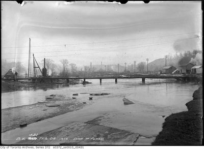
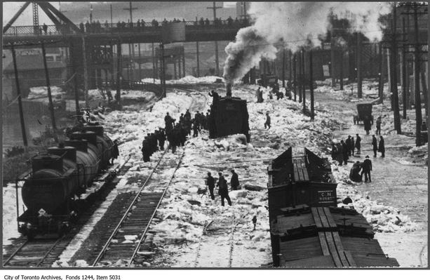
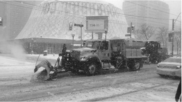
This should help me remember what I've read, force me to think about how the content of my research is, which is endlessly influencing my art, and share it. It should also help me read books which are pertinent to my interests and focus my attention. Here are a few of which are on my list, and some that I have been reading over and over already. HTO: Toronto's Water from Lake Iroquois to Lost Rivers to Low-flow toilets, by Wayne Reeves,Christina Palassio. Reclaiming the Don: An Environmental History of Toronto's Don River Valley, by Jennifer L. Bonnell. In the Skin of a Lion, by Michael Ondaatje Eau Canada: The Future of Canada's Water, published by Karen Bakker. Tales of the Don, by Charles Sauriol. As well as Remembering the Don: A Rare Record of Earlier Times Within the Don River Valley. Having started recently to research specific items for the rivers + time + cities artwork, my focus has been on the Don River. Spending time the Toronto Archives, a photograph of snow removal trucks dumping snow into the Don river, struck a chord with me.
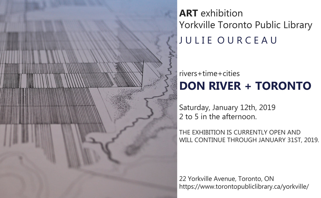
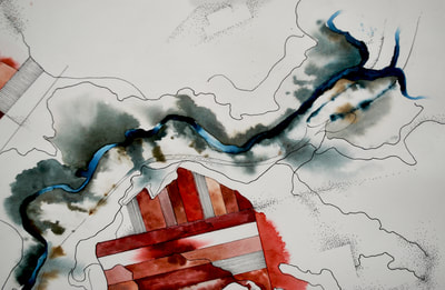
Why would the city of Toronto chose to harm our plants and animals by dumping salt and sand into our river, yet plan a revival of its trails and river beds? We know that in the 60's Toronto treated the don as a sewer system, People like John Routh, the Don Watcher, are an inspiration to me. This activists' blog is truly beautiful, Please take the time to visit it. My next focus is the don river + toronto, where I will map, draft and record key moments in time, creating a fusion on paper. Events like 18th and 19th century mills, breweries and brickworks being established, bridges and parkways being erected, trails lost and re-created, naturalists picketing and wildlife nesting. I am truly excited to turn my attention to this river! 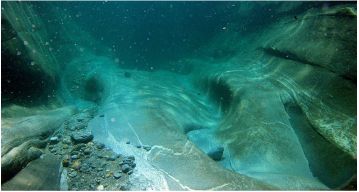 I've posted a few drawings which consider the River at the heart of each map and drawing. The case studies and abstractions are based on instinctive responses to historical data and
maps. Water and its availability and quality will be the main pressures on, and issues for, societies and the environment under climate change. My current project Rivers + Time + Cities is one which has me reflect on Rivers; sources of both abundance and destruction, life and death, they have had a powerful hold on humankind. The rise of civilizations has always been inextricably linked to the successful management of water when there was either too little or too much of it. I hope to post regular findings, historical links and videos which relate to my project discoveries, one which is in search of artistic expression, yet linked to an urban and ecological evolution. |
about the authorThe blog connects thoughts on Landscape and Architecture, design, and mostly the connections between landscape architecture, art and our beautiful Toronto. archives
February 2022
|
